The Ceasg, the Saltire and the Thistle – More Scottish Legends

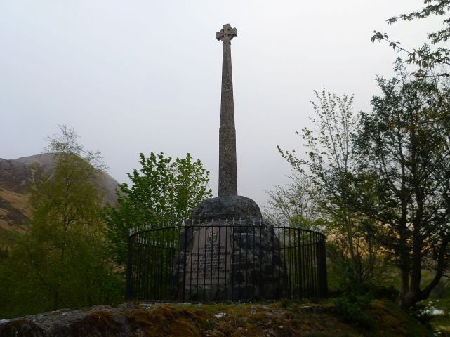
In previous blog posts, we have featured a variety of creatures from Scottish folklore, as well as a couple of legends, such as the tale of King Robert the Bruce and the spider. Today’s post is about another mythological creature, along with the legends behind Scotland’s flag and national flower.

Ceasg

Ceasg

Also known in Gaelic as maighdean na tuinne (maid of the wave) or maighdean mhara (maid of the sea), the ceasg is said to have the upper half of a beautiful woman and the tail of a salmon. Found in the sea, as well as rivers and streams, the ceasg has the ability to grant three wishes if she is captured. Often she will marry a human man (in some versions of the legend the man has been promised to the ceasg), and any sons they have are destined to become fantastic sailors. Eventually, though, the water calls the ceasg back. As a form of mermaid, there are malevolent tales associated with the ceasg. She will sometimes swallow the man whole (or his wife if he is already married), and it takes the destruction of the ceasg’s soul (kept apart in a magical object, often an egg), to stop her and return the person to safety.

saltire

The Saltire

Scotland’s flag is a white diagonal cross on a blue background. There are claims that the Saltire is the longest continuously-used national flag in the world, a claim also held by several other countries’ flags, such as Denmark’s. However long it has been in use, its origins are closely associated with Saint Andrew, Scotland’s Saint; another name for the Saltire is St Andrew’s Cross. The legend is that Andrew, who had been one of Jesus’s disciples, was crucified in Greece, but feeling too unworthy to have the same manner of death as Jesus, Andrew asked for the cross to be rotated so that it resembled an ‘X’. In tradition, the appearance of Andrew’s cross in the sky (clouds = white and sky = blue) in the 9th century spurred the Scots to victory in battle, and from that moment it became linked with Scotland.
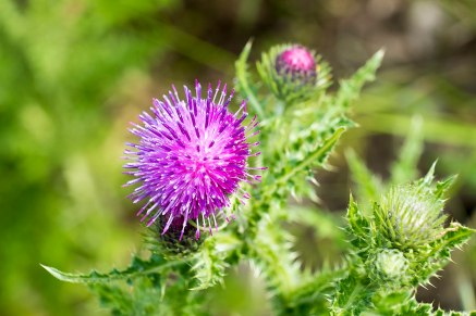
1280px-Thistle_(34858954295).jpg

The Thistle

The thistle has been a national emblem of Scotland for centuries. There is a legend that in a planned attack upon the Scottish army (perhaps the 13th century Battle of Largs), a bare-footed Norseman stepped on a thistle, cried out and, consequently, alerted the Scottish. The spear thistle is thought to have been the species referred to, being abundant in the country at the time, though others, including the musk thistle and the melancholy thistle, are also contenders. According to the legend, it is this incident that lead to Scotland adopting the thistle as an important national symbol. Associated with it in official use is the Latin phrase Nemo me impune lacessit, which translates to “no one provokes me with impunity.”

We hope you enjoyed this short eclectic post. As always please like, share, comment and tweet.

All the best, The Culloden Team


Natural History of Culloden

Culloden Moor is a very special location. Not only is it the site of the last pitched land battle fought in the British Isles; but it and the surrounding area act as an important refuge for countless species of plants and animals. Culloden benefits from featuring a multitude of habitats – each with their own unique flora and fauna. Today we shall take a look at these habitats, learn about some of the creatures that inhabit them, and the conservation work undertaken on the moor to ensure that the battlefield remains not just a place for memory, but an important ecological refuge for many rare species.

The first main habitat to look at is grassland. On the day of the battle the moor was primarily used for grazing – our Shetland cows are a call back to this previous land use. Today the grassland habitat at Culloden is home to a variety of different plants: Thistle, gorse, willowherb and foxglove (some previously mentioned in our posts about medicinal plants).  In terms of animals the grassland is populated by vast numbers of insects and arachnids; when walking the battlefield particularly in spring and summer you may catch sight of a garden tiger moth caterpillar. These hairy caterpillars sometimes walk across the paths looking for more plants to munch so take care not to step on them! Garden Tiger moths have been on the decline since the 1970s so having them at Culloden is important.

Culloden Battlefield cows (01 of 10)
Shetland Cows at Culloden

Conservation wise perhaps the most important species in Culloden’s grassland environment is the Skylark. Chances are you will hear them before seeing them; these small birds fly as high as possible and sing as loud as they can to mark their territories. If you hear a loud bird on the moor look up and see if you can spot it. Skylark numbers have plummeted with numbers dropping 75% between the 1970s and 1990s – with threats including fewer places to nest – making them a red list species. The fact skylarks not only live but also nest on the moor makes Culloden a very important place for these rare birds.

Another important habitat on the battlefield is the quintessential bog/moorland habitat. Moorland is home to many damp-loving animals and plants like frogs and newts which frequent the ponds and pools. A personal favourite plant of mine can be found here – the horsetail. A living fossil that has been around since before the dinosaurs it gets its name from its appearance resembling the tail of a horse. 3000 million years ago Scotland was covered in huge forests of horsetail with some reaching heights of over 100 metres!

horsetail
Horsetail

This fragile habitat is at risk of a process of “succession” – where it runs the risk of turning into woodland if trees are allowed to grow unchecked. If a forest grows it will dry up the moor and the special animals and plants that live there are lost. At Culloden we help preserve this habitat and halt succession through manual work and grazing via livestock to keep the moorland healthy.

Technically we’re cheating here since this is not on Trust land but the third main habitat found on Culloden Moor is woodland. Until the Trust purchased our part of the battlefield Culloden Moor was almost completely engulfed with woodland. The Forestry Commission today manages the woodland around the battlefield, and is home to animals such as jays, roe deer and, perhaps most importantly of all, red squirrels – whose populations have plummeted following the introduction of the invasive grey squirrel from America.

Next time you visit the battlefield be sure to look out for any of our special flora and fauna that live here, and if you find anything interesting be sure to report it! Who knows what else rare, strange and special may be living here at Culloden Battlefield.

We hope you enjoyed this post. As always please like, share, comment and tweet.

All the best,

The Culloden Team

Battlefield Plants and their Uses

In 2015 we wrote a blog post describing the uses for certain plants found on Culloden Battlefield, with particular focus on their medicinal properties; here are four more plants that can be seen at Culloden, along with information detailing what they were used for in the 18th century:

Foxglove (Digitalis Purpurea)

foxglove
Foxglove

In Gaelic the flowers are called lus nam ban-sith. This translates to ‘fairy woman’s plant’, and is a reference to the legend that the mottled markings on the inner petals are fairies’ fingerprints. Flowering between June and September, foxglove can be found on rough heath-like ground on the battlefield, towards the Jacobite line.

The leaves of foxglove were used to treat dropsy (painful swelling of the body and limbs). These leaves, usually mixed with other herbs, were chopped and taken as a drink. Foxglove contains digoxin, which slows and strengthens the muscles of the heart. It was also used to help treat arthritis and diphtheria; the leaves, mixed with butter and onion, were applied to the joints and the neck respectively.

Willow (Salix)

willow
Willow Tree By Jdforrester

At Culloden the willow tree grows on areas of wet ground and resembles a large bush. The Gaelic word for willow is Seileach.

The flowering willow’s sap was taken to improve vision. Willow bark contains a derivative of salicylic acid, which once powdered, was mixed with water and taken to relieve pain and reduce fever.

In addition to its medical benefits, willow was also used to tan leather, make baskets, make ropes (out of its saplings) and dye wool; the bark produces a reddish-brown colour, and the leaves produce a yellow colour.

Tormentil (Potentilla Erecta)

tormentil
Tormentil by Anne Burgess

These are small yellow flowering plants that grow on damp heathery ground. Their Gaelic name is Braonan Bachlay, which means ‘earth nut’. Tormentil flowers from June to September.

Tormentil was used for a variety of medical problems: to treat sunburn, the entire plant was boiled in water and acted as a cooling lotion; to treat a sore throat, the flowers and shoots were mixed in a drink form and gargled; to treat sore lips and gums, chewing on the root of tormentil was recommended; and the root was also used, dried or fresh, to help with stomach issues, piles and ulcers, as well as other sores.

Tormentil was also used for dying wool (its roots producing a reddish colour) and for tanning leather and making fishing nets. The roots of tormentil took a while to dig up, and so they were only used if there was no tree bark available.

Rowan (Sorbus Aucuparia)

Rowan_tree_20081002b.jpg
Rowan Tree by Eeno11

Rowan has a couple of names in Gaelic: Craobh Chaoran, which means ‘berry tree’ and Caorunn, which means ‘wood enchantress’. Rowan trees were strongly believed to ward off evil, with many people carrying a sprig about with them for protection. At Culloden, there is a Rowan tree beside Leanach Cottage.

Rowan bark, applied as a poultice, was used to treat adder bites, and mixed with apples and honey, Rowan berries were used to soothe the throat in cases of wheezing cough.

Outside of medical use, the wood was used to make dwellings (summer sheilings), coffins, sticks for urging on cattle, wheels, barrels and churns, among other things. The berries, fermented, made a juice resembling cider, and, depending on the pot they were boiled in, produced a black or orange dye.

We hope you enjoyed this post. As always please like, comment, tweet and share.

All the best, The Culloden Team


The Highland Clearances

A controversial chapter in Scotland’s history, the Highland Clearances are mostly looked back at with sadness and some bitterness. The ‘Clearances’ refer specifically to the period in the mid-to-late 18th century to the mid-19th century in which tens of thousands of Highlanders were evicted from their homes; it is also used more broadly to include the restriction on tartan and other rules that altered the Highland way of life forever. To many, the Clearances are an example of ethnic cleansing but others consider them an economic necessity, a result of the industrial revolution. To the latter set of people, the Clearances are known as the ‘Improvements’.

After Culloden, and the defeat of the Jacobites in 1746 the Government introduced the Heritable Jurisdictions Act 1746, which reduced the powers of the Clan Chiefs to those of a landlord. The Act of Proscription, also introduced in 1746, restricted the wearing of tartan, as well as the ownership of weapons. The Government were brutal in enforcing these laws, with many Highlanders being killed for the slightest deviation from the new laws. Charles Edward Stuart had escaped to France, and the Highlanders attempted to get by in Scotland’s changing climate.

The reduction of the powers of the Clan Chiefs weakened the relationships between them and the rest of the people. Many Chiefs, as a result of attempting to keep up with their acquaintances in the Lowlands, England and other places in Europe, were in debt. Tacksmen (Gaelic: Fear-Taic meaning ‘supporting man’) had paid an annual sum to the Clan Chief for a bit of land, and then let it out to sub-tenants for rents. Wanting to cut out the middleman, the Clan Chiefs phased out the position of the tacksman. Out of jobs, many former tacksmen emigrated to Canada and America.

Wool sold for a high price, and the Highland landlords realised that they could make more money from sheep, specifically the Cheviot and the Blackface, than from people. The rents were increased, and when inevitably many of the tenants were unable to come up with the money, they were evicted. Sheep farmers from the Lowlands and northern England came up to take their place. An addition financial benefit for the landlords was that as there were fewer people to collect from, the administrative costs were lower.

The former tenants moved either to industrial cities in Scotland, other countries or small crofts, mainly located on the coast. The weather made for hard working conditions, and there are reports of the women, while they worked, having to tie their children and livestock to posts to prevent them from being blown into the sea or off a cliff.

Despite the uncertainty and hardship endured by many of the Highlanders, there were still a significant number of people motivated purely by profit. The Duchess of Sutherland had about 15,000 people evicted from the Sutherland estates, ordering hundreds of crofts to be burned in the process; her factor went to trial for presiding over the burning of a croft that contained an old woman who had refused to leave and for letting his sheep eat the other crofters’ corn. For both he was acquitted, which the crofters put down to many of the jury members being landowners.

The population continued to grow. People viewed it as proof of Scotland’s strength, but in reality it was putting increasing strain on everything. In the 19th century, the combination of the failure of the kelp industry in the 1810’s and famine led to more and more Highlanders emigrating, mainly to Canada, Australia, the US and the rest of Europe.

It is believed that around 150,000 Highlanders were removed from or left their homes in the entire process of the Highland Clearances. Of this number, many, either immediately or after further attempts at living in Scotland, emigrated. Today the descendants of these people are now scattered across the world resulting in a massive sharing of Scottish heritage.

We hope you found this article interesting. As always we love to hear your comments and read your thoughts on these topics.

All the best,

The Culloden Team

Grave markers at Culloden

When people visit Culloden Battlefield most will inevitably head out across the moor and stand in front of the large memorial cairn in the centre of the field. Surrounding the cairn are most, but not all, of the grave markers on the field so it seems fitting to turn our attention to the history of these markers.

Old photo of the Clan Mackintosh marker


The markers on the battlefield were put in place in 1881, some 130 years after the battle. One of the main question we are asked regards the names on the stones, as many carry the names of one or more clans who fought at Culloden. We have had geophysical tests of the area completed and they show that the area around the cairn does indeed hold many mass graves but how the names on the gravestones were chosen is something of a mystery.

clanstones
Selection of gravestones at Culloden


Clansmen would not have been easy to distinguish from one another. There was no clan tartan back in 1746 so identifying a persons clan relied on smaller things that their cap badge or clan plant that men may have worn. After the battle it would have been incredibly difficult to accurately determine who was from which clan so it is believed that the markers on the field are symbolic of the major clans who fought at Culloden and who suffered significant losses.

As well as the marker by the cairn, there are a few others across the field. Further north are three stones that commemorate the MacDonald’s who fought on the far left of the Jacobite front line. Whilst they did not take part in the hand-to-hand combat that occurred further south they were instrumental in aiding the retreat of the Jacobite army. Each year at the anniversary of the battle the local MacDonald clan and supporters will march down to the stones after the main ceremony to lay a wreath for the men.

Clan Donald stone
Clan Donald Stone


Perhaps one of the most annoying and intriguing stones on the battlefield is that of the ‘Field of the English’. This stone lies behind the front line of the Government troops and supposedly marks the site of a grave of the Government men who died during the battle. However, there are two issues we have with the stone. Firstly, research has shown that there is no sign of a mass grave by the stone. The nearest lies some fifty yard to the West of the stone. Secondly, its inscription, ‘Field of the English’. As we know this is not accurate. The Government army was not an English Army, it was made of men from Scotland, Wales and England making it a British Army.


Despite some questions on the accuracy of the markers though there is no doubt to how special they are to the site. Many who visit take a moment as they walk past the stones to take in the incredible atmosphere of the battle and remember the history of the site.

We hope you enjoyed this short piece about the marker as always please like, share, comment and tweet.

All the best, The Culloden Team

The Stunning Standing Stones of Scotland

We are lucky enough to be situated just five minutes from the standing stones at Clava Cairns which are proving to be very popular with visitors. But why does Scotland have so many of these intriguing standing stones?

clava
Aerial View of Clava Cairns from Visit Scotland


The honest answer is no one really knows! Throughout Scotland there are stones arranged often in circular patterns that have no clear explanation as to where they came from or why they are placed in such ways. The stone circle at Callanish on the Isle of Lewis is thought to date from 5,000 years ago making it one of the oldest structures in the UK. How they were formed is also a mystery. Some of the stones in these formations can weigh up to 10 tonnes, so how were they transported and placed into position?

callanish
Calanais Standing Stones

Many of the stones are believed to be part of ritualistic sites with many forming elaborate burial grounds used to commemorate the dead. At Clava Cairns there are three such burial chambers which are surrounded by standing stones. These can be clearly seen as the walls of the burial tombs are made from stones which are still standing. Over on Orkney there are the Stones of Stenness and the Ring of Brodgar which are believed to be all that remains of large ceremonial sites. It is believed the stones were once surrounded by a large ditch with a central meeting point.


One of the most interesting things that seems to connect most sites is the relationship they seem to share with astronomical events. Many of the sites, including Clava Cairns, are aligned to the movements of the sun and moon and in particular the event of the  solstices. At Clava one of the burial cairns is aligned so that the sunset perfectly aligns with the entrance to the cairn on the Winter solstice.

brodgar
Ring of Brodgar from Visit Orkney


Whatever the purpose of these Neolithic sites, whether they be ceremonial, religious or elaborate burial grounds, today they are sites of incredible beauty and fascinating engineering. The stones capture peoples imagination and their sites are typically in peaceful settings with beautiful scenery that allow visitors to escape the modern world for a while and soak in the atmosphere of these incredible places.

We hope you enjoyed this little foray into the standing stones of Scotland. As always please like, share, tweet, comment and find your own favourite set of stones, although with hundreds to choose from it may be tricky.

All the best, K & D

The Might and Majesty of Glencoe

Glencoe is a beautiful part of Scotland that is rich, not just in landscape, but also history so today we thought we share a little bit about why we love the spot so much.

Firstly, the landscape. You cant help but love the drama and scale of Glencoe, even if you’ve lived in Scotland your whole life it is still a fantastic place to visit and drive through. A drive through the valley is always enjoyable not matter what the weather is. In the sunshine the hills look stunning and if you’re really lucky you can sometimes catch a glimpse of a golden eagle. Summer is also the perfect time to try some of its many walking routes as the site houses eight Munros. Don’t worry if it’s been raining though. When you get the clouds and the rain Glencoe transforms into an area of classic Scottish atmosphere and the waterfalls through the glens descend from the clouds in a fury.

glencoe
Glencoe on a beautiful day


The site is very popular with walkers as there are a number of routes and ascents to explore. One of the most popular routes is up the ridge of Aonach Eagach but it is not for the faint hearted. The route travels along a narrowing ridge so anyone with vertigo should certainly avoid it. You can also explore the peaks of the Three Sisters which encompasses the ridges of Beinn Fhada, Gearr Aonach and Aonach Dubh and makes a lovely day of hilltop walking.

GLE Glencoe
Glencoe looking very atmospheric


For anyone who knows their Jacobite history, as we are sure many of you do, Glencoe is also the site for the infamous Glencoe Massacre. It was here in 1692 that members of the MacDonald clan were killed by soldiers of the Campbell clan for not pledging allegiance to William III. The attack was launched at dawn and at least 37 men were murdered in their homes with as many as 40 women and children dying from exposure after they were forced out of their homes. No one was ever brought to trial for the massacre and the site is remembered to this day as a brutal part of Scottish history.

glencoe3
Memorial for the Glencoe massacre


Associated with the massacre is the point of Signal Rock. This spot is, according to legend, said to be the point at which a fire was started to signal the start of the massacre in 1692, however there is no proof of this being the case. The site is also said to have been an emergency meeting point for the MacDonald clan where they would gather in times of danger. Whether either of these are true is unsure but the rock is a beautiful spot to walk out to and would have been a good beacon point for the glen due to its visibility.

glencoe4.png
Signal Rock at Glencoe


We hope you get the chance to visit Glencoe, if you haven’t already. It is such an amazing place and pictures just do not do it justice. As always we hope you enjoyed reading our post and please like, tweet, share, comment and tell us your favourite parts of Glencoe.

All the best, K & D

80 Years of Care

This year marks the 80th anniversary of the National Trust for Scotland caring for and conserving Culloden Battlefield.

arch
Culloden Battlefield


In 1937 Alexander Munro of Leanach Farm presented the first two small pieces of the battlefield to the reasonably new charity, the National Trust for Scotland. This small start was soon expanded and over the years we have acquired more of this historic site and worked hard to preserve the land and share its story with millions of visitors.

We are incredibly proud to be the custodians to such an important site in Scottish and world history. Today 80 years own, we care for the memorial cairn and clan graves on the battlefield; as well as the Cumberland stone, the ‘Field of the English’ and Kings Stables Cottage. We help protect a large portion of the southern part of the battlefield that encompasses the main area of hand-to-hand fighting, as well as the mass graves of the men who fought and died here in 1746.

25613 Culloden 259
Clan Grave at Culloden


The task of caring and preserving such a special site is not an easy one and new challenges are constantly presenting themselves but they are challenges that everyone is determined to meet. We have a dedicated facilities team on site who monitor the land and work to try and restore the landscape to how it would have appeared at the time of the battle.

On site we also have our learning team who produce top class school programmes to deliver to children throughout Scotland and indeed the rest of the world. They share the stories of the battle and the significance of the events that took place here in ways that captivate the younger audience and spark interest in new generations every year.

Culloden, Inverness.
Culloden Moor


As the last battle fought on British soil and the battle that effectively ended the Jacobite campaigns in Scotland, Culloden is a part of our history and our culture and we hope to be here in another 80 years still sharing the stories of Culloden with people from around the world and caring for this incredibly important site.

We hope you get the chance to visit Culloden if you haven’t already. As always please like, tweet, share, comment and if you would like to join us in helping conserve this special place head to https://www.nts.org.uk/Donate/ to donate.

All the best, K & D

Archaeology at Culloden

With 2017 being the Year of History, Heritage and Archaeology we had to take a look into the archaeology here at Culloden. Something that many people may not know about Culloden is that it was one of the first battlefields in Scotland to be subject to archaeological investigation making it an intriguing subject.

arch
Culloden Battlefield

As part of the Culloden Battlefield Memorial Project, work first began at the site in 2000 and has included topographic, geophysical and metal detector surveys.

These surveys have allowed us to discover and learn more about the battle and what exactly happened on that fateful day in April 1746. The fact that objects and details discovered hundreds of year after an event can help inform our knowledge is a fantastic and intriguing subject.

Unsurprisingly, metal detector surveys managed to uncover a lot of items from the field including musket balls, mortar fragments, buckles and buttons many of which we have on display in our exhibition. The interesting aspect of these finds though was their location. When mapped all of these individual finds suggested the battle took place over a larger piece of land than originally anticipated.

mortar
Mortar Fragments and Grape Shot

The intensity of finds also showed the majority of  hand-to-hand fighting took place further south than expected. The presence of broken musket pieces indicated the weapons were damaged by fire at close range or smashed off by a broadsword. The lost buttons and buckles most likely removed in struggles which offers an insight into the extreme battle conditions on the moor. These lost items open up a harrowing picture of Culloden and bring the battle into a harsh reality with objects you can truly connect with.

Close to the area of close quarter fighting were fragments of mortar bombs which would have been fired into the charging Jacobites to stop their dreaded attack. The power of these bombs could take out up to twenty men at a time, making it remarkable the Jacobites made it to the Government front line at all. The position of the mortar fragments, so close to the Government front line, also opens up the possibility that Government men could have been killed as the shells were rather unpredictable and broke apart as the powder inside ignited.

cross
Pewter Cross

As well as gathering information on the fighting and tactics of the armies surveys also helped uncover a couple of more personal items. A silver coin was found dating from 1752, after the battle. The coin is a silver thaler from the Duchy of Mecklenburg-Schwerin which was one of the German Baltic states. The presence of the coin suggests the possibility that it was dropped by a soldier who had served time in the continent. They could even have been based at Fort George and travelled to the battlefield to visit the graves of some of their fallen comrades. Also found was a small pewter cross. This discovery near Leanach Cottage is a beautiful pendant and you cant help but wonder who it belonged to and the story behind it. Was it given to a soldier by a loved one? Was it kept close for luck? The stories that could lie behind the objects make them all the more special and important to preserve.

We are lucky to have found so many items that have opened up new theories of the battle of Culloden and raised new questions and thoughts about the men on the field. If you want to find out more be sure to come along to our exhibition to see the finds for yourself. As always we hope you enjoyed this brief insight into the archaeology of the site and please comment, like, share and tweet.

All the best, K & D


Something off the beaten track…

Most of the properties the National Trust for Scotland looks after are pretty well known and are easy to find on the map but there are a few that are tucked a little bit away from the main path. Today we choose a few of our favourite lesser known properties.

Firstly, the one nearest us, Boath Doocot.

boath
Boath Doocot


This is a small 17th century doocot (or dovecote if you prefer) which stands looking over the site of the Battle of Auldearn which took place in 1645. Just 20 minutes from Culloden it makes a nice stop between ourselves and Brodie Castle to pack a little bit more history into your trip. The doocot stands 7.5m high and houses 515 nesting boxes within its walls. It was donated to the NTS in 1947 by Brigadier J Muirhead of Boath.

Out west we have the ruins of Strome Castle.

Strome castle ruins
Strome castle ruins


One of the best things about this castle is its location as it sits on a little rocky outcrop at the end of Loch Carron offering gorgeous views out towards the Isle of Skye. If you catch it on a sunny day then it is a wonderful drive out along the west coast. The castle is believed to have been built in the 14th Century and changed hands many times over the centuries. Finally in the 1600’s it was besieged by Kenneth MacKenzie, Lord of Kintail and was eventually blown up.

To the east in Fife we have Balmerino Abbey.

OLYMPUS DIGITAL CAMERA
Balmerino Abbey ruins

Though now ruins the abbey was once an impressive Cistercian monastery from the 13th Century. Whilst it may not be as fancy as it once you can still see the beautiful stonework and the arches of the cloisters. Also in the grounds is a beautiful Spanish chestnut tree that is said to be amongst the oldest in Scotland. Tradition says it was planted in 1229 by Queen Ermengarde but more recent studies have shown it to be roughly 500 years old.

Finally why not head out to see Black Hill.

Black Hill


Found not far from Glasgow this hill makes a wonderful walk on a nice day. From the top are lovely views down the Clyde Valley and the hill also has a rich archaeological history. The site is home to a Bronze age burial cairn and was once an Iron Age fort. The area was donated to the National Trust for Scotland in 1936 and was designated a Scheduled Ancient Monument in 1969.

We hope you enjoyed reading about this different places. As always please tweet, comment, share and try to check out some of these places for yourself.

All the best, K & D